
Explore the Blog
How Nashvillians Can Reduce Energy Consumption
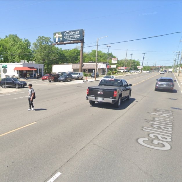
Creating Crosswalks on Gallatin Ave

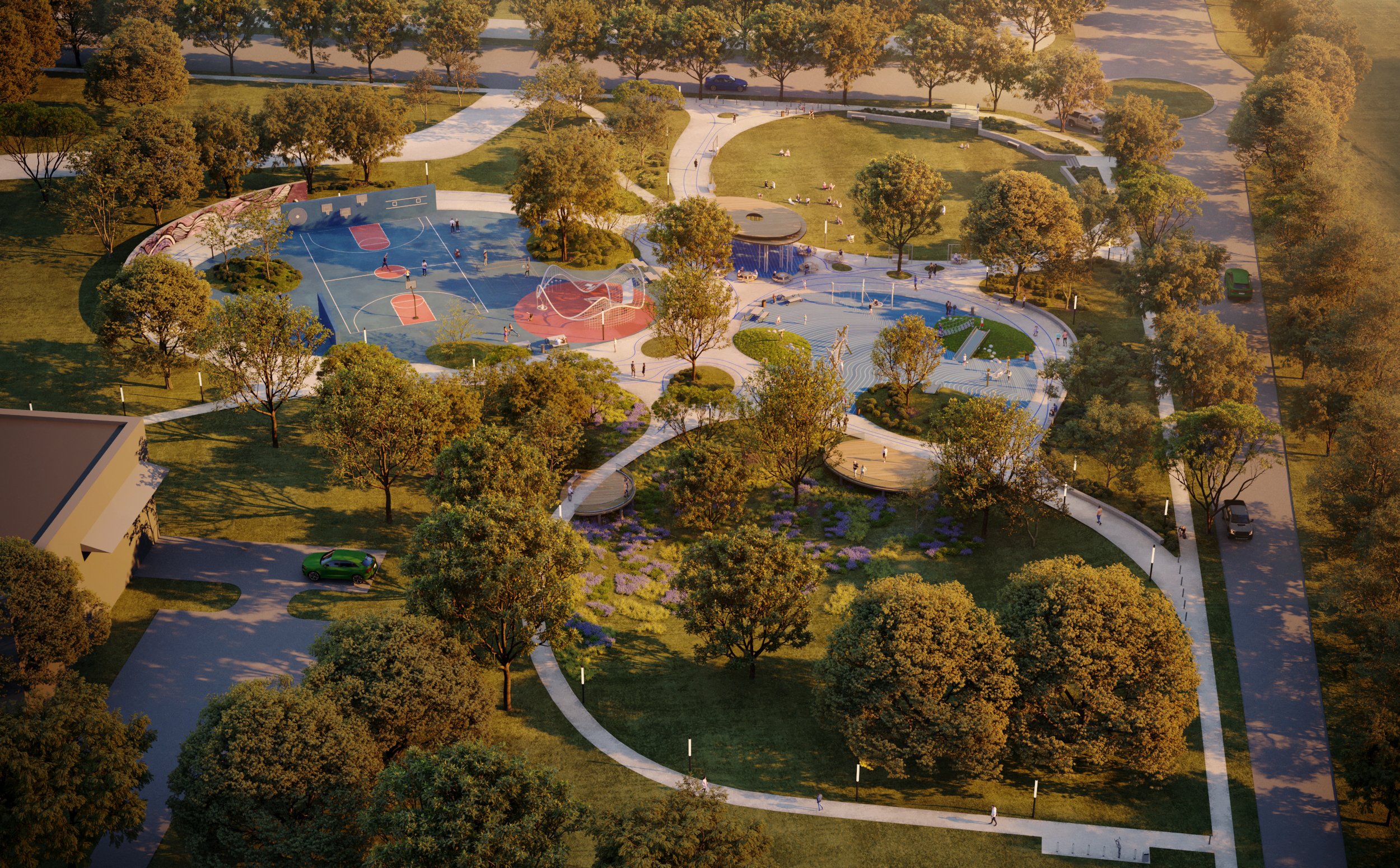
Youth Transform Antioch Park with mini-pitch

Education is a lighthouse at Robert Churchwell
Posing a Paint Challenge
Something New coming to Madison Station

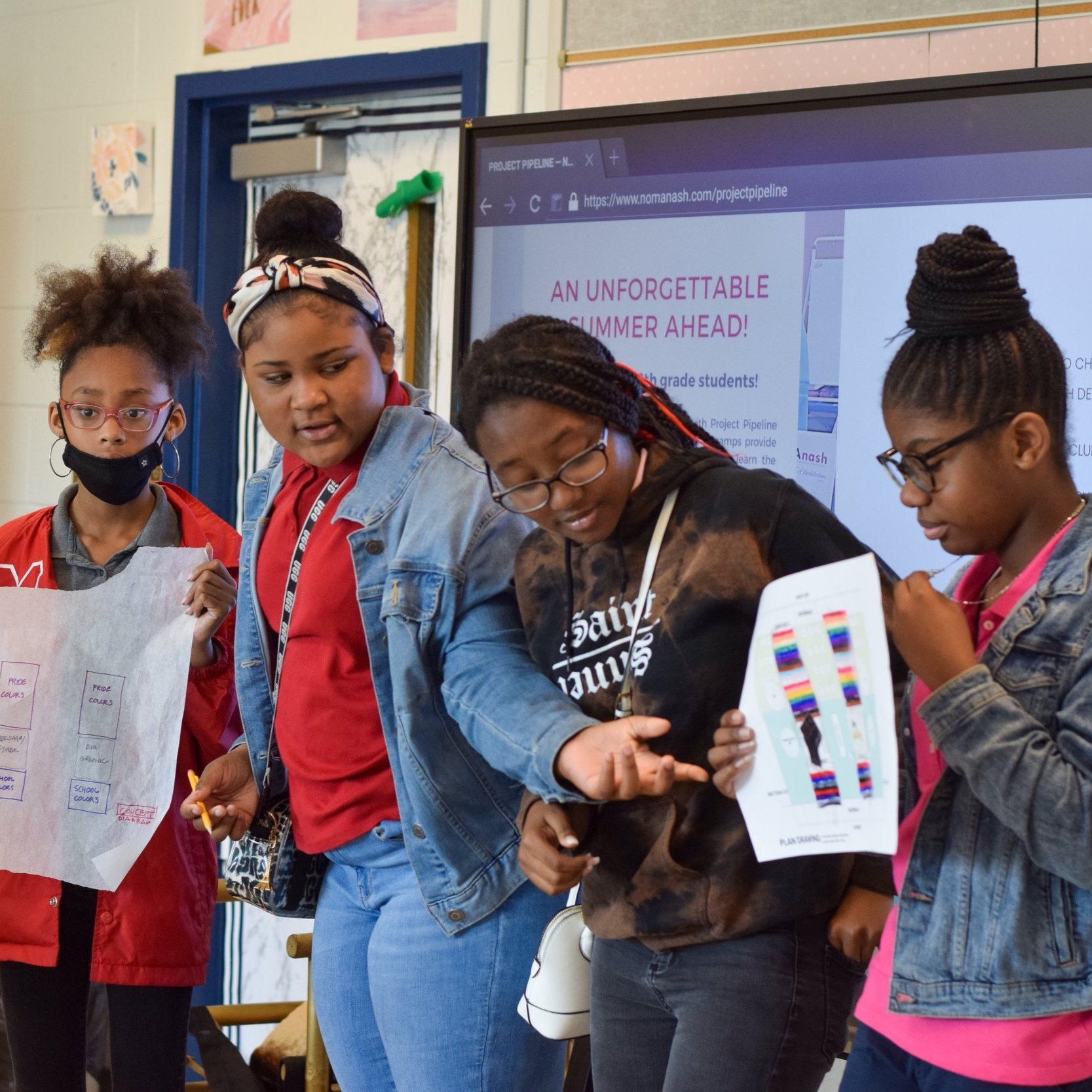
Nashville Youth Design Team Final Projects

Prioritizing Placemaking for 2nd Avenue
Strengthening community through placemaking
Evaluating ULI Recommendations for 2nd Ave
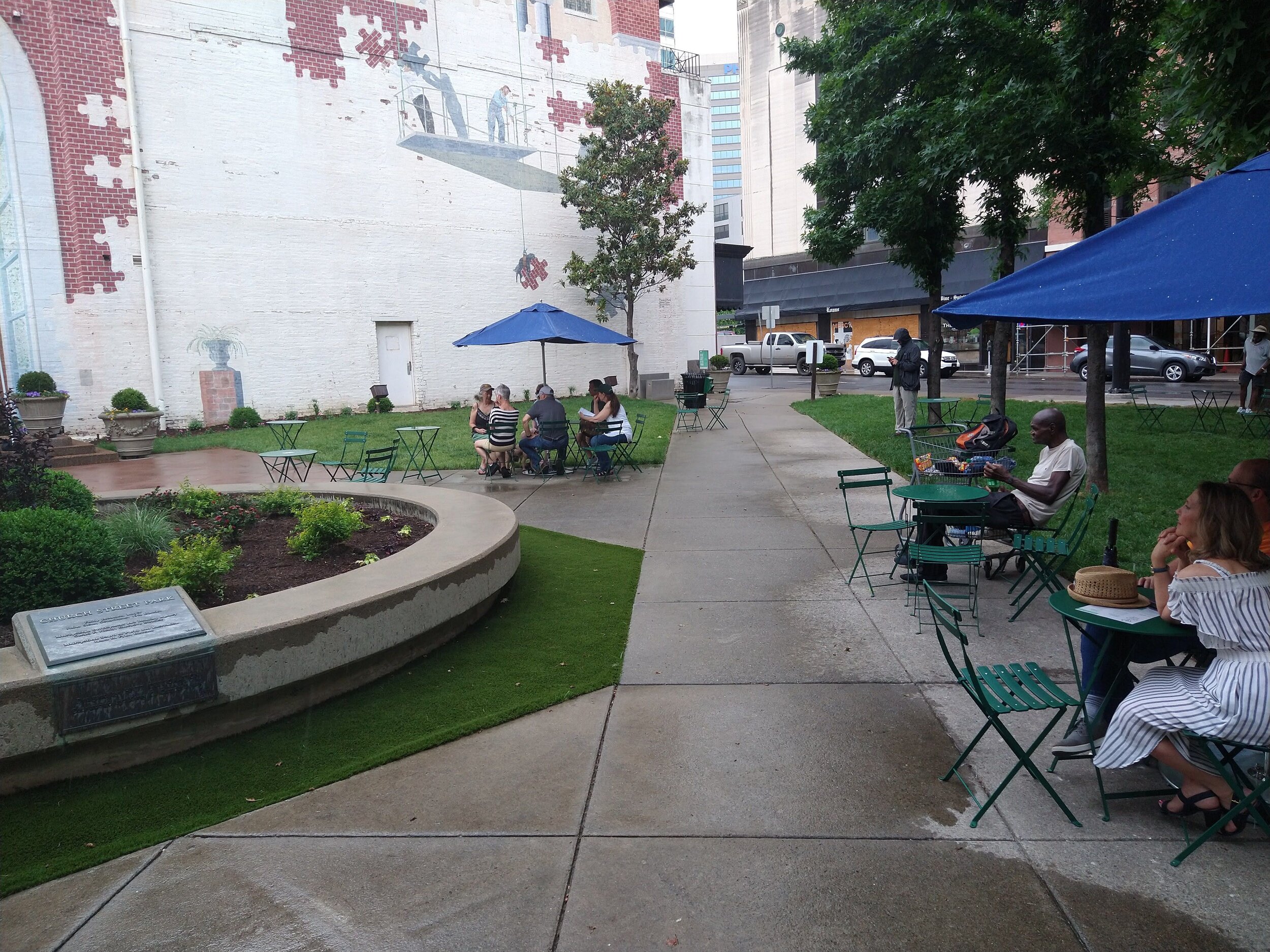
Church Street Park Summer Revival
Visioning Donelson Library Plaza Park

Let’s Color Nashville

Transforming Downtowns for Pets

High school Students map wellness data
Victory Memorial Bridge Park
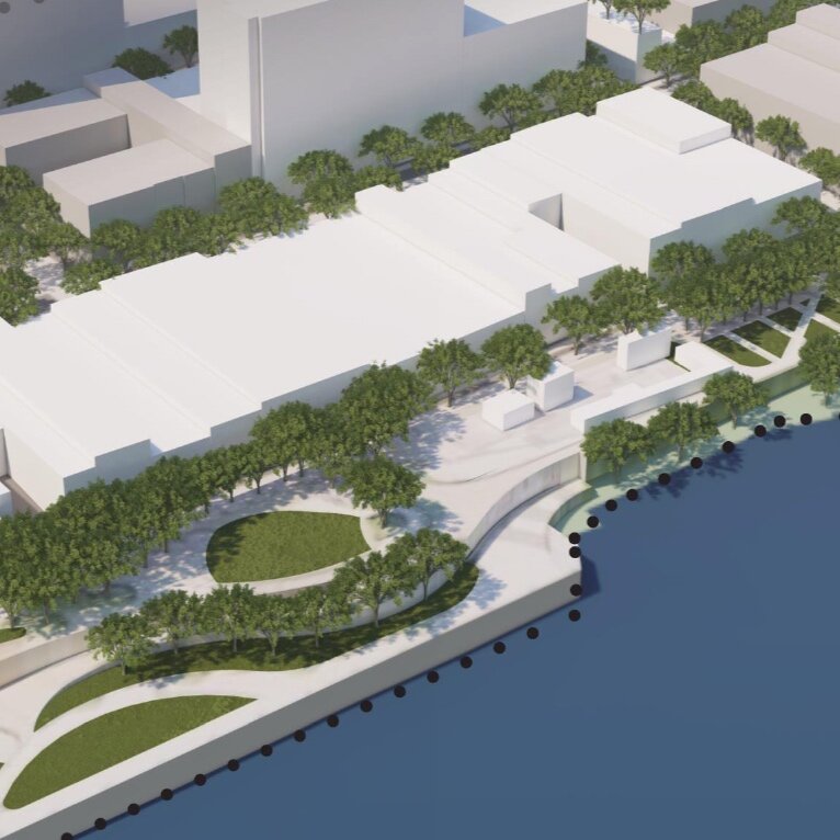
With development along the Cumberland Riverfront on the horizon, it is imperative to consider how improvements to connectivity and public space can increase the quality of life in and around downtown Nashville. Throughout Nashville’s history, the Cumberland River has played the role as the epicenter of Nashville’s identity and evolution. It served as a means of transportation and survival in Nashville’s early Native American history, and later European settlements. “It was the river that was the initial lifeline to the rest of the world, connecting Nashville to the Ohio, Tennessee, and Mississippi Rivers—and beyond.” (The Plan of Nashville: Avenues to a Great City). Throughout the early 1800s, the Cumberland continued to act as a key contributor to the economic development of Nashville, connecting the emerging city to major ports like New Orleans by steamboat. By the end of the 19th century, the Cumberland River was at the core of Nashville’s successful industrial economy.
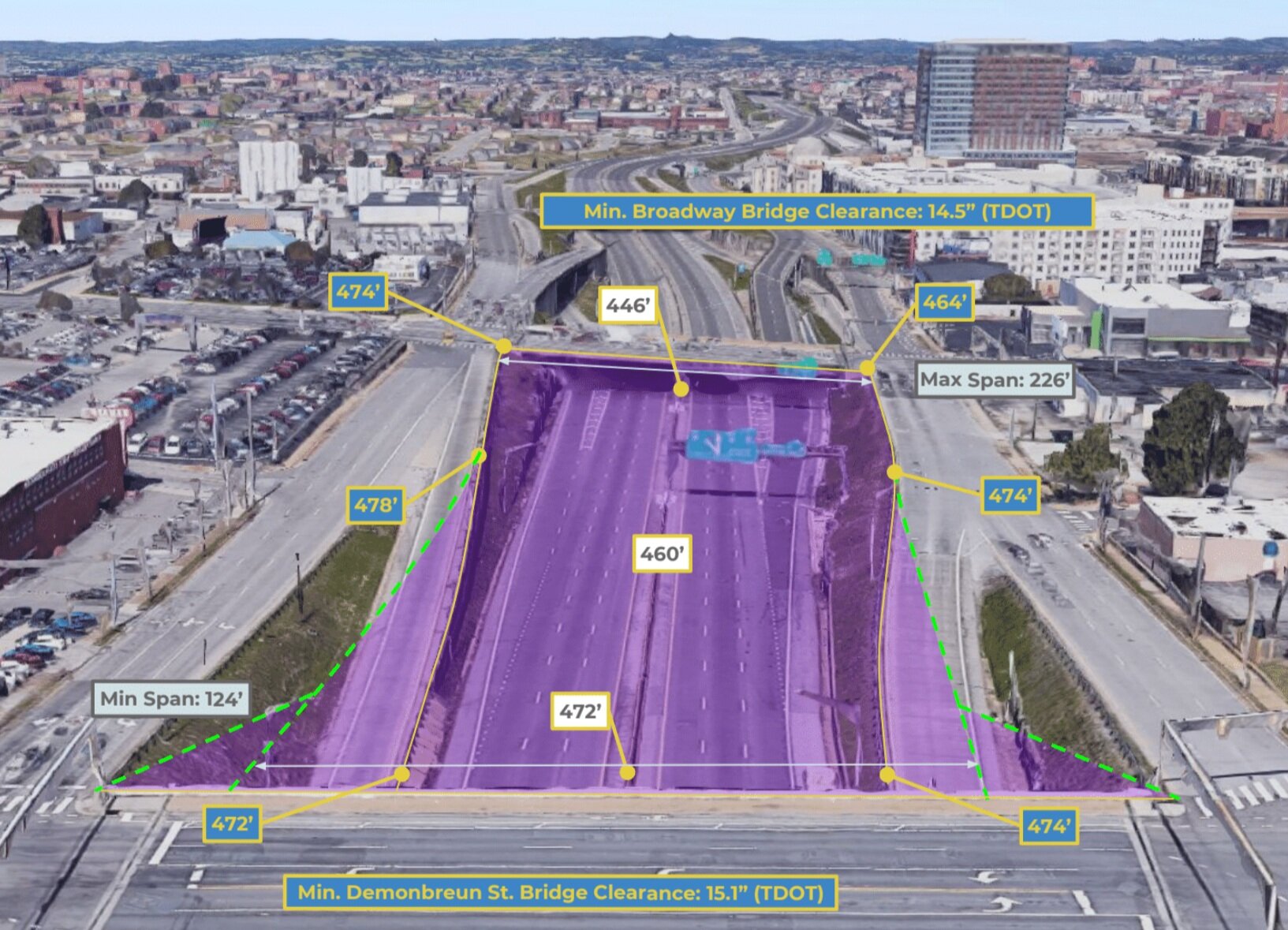
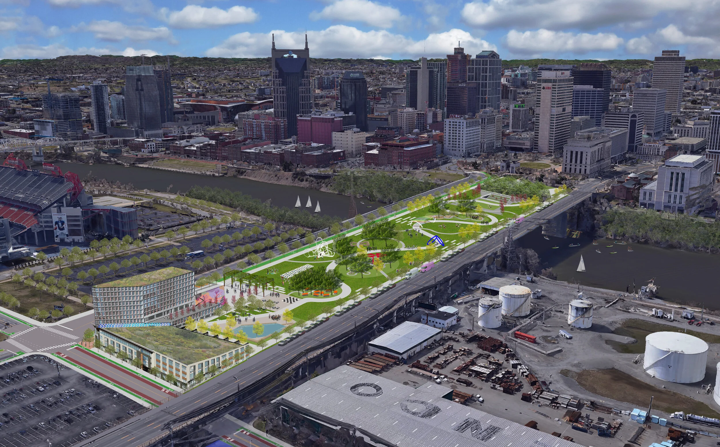
Capping The Interstate
Cities across the US are revisiting the functionality of interstate highways in downtown areas to better connect neighborhoods bisected from mid-century infrastructure. Areas with existing interstates below the grade of a city’s primary street grid have the potential to be capped with a more functional addition, reconnecting the two sides of the interstate. Most examples accomplish this by creating a new public space, in the form of a park, or by constructing a larger bridge to accommodate new liner buildings.
Publication: Franklin Pike Multi-Modal Path
A study of Franklin Pike exploring the possibility of new bike lanes and enhanced mobility features in Oak Hill.
Neighborhood Assessment Toolkit
As a tool towards education and active citizenship, the Toolkit offers local communities a greater voice in determining the future of their neighborhood
Publication: The Charlotte Avenue Healthy Corridor
Presenting a 20-year vision for high density, mixed-use, transit-oriented development (TOD) that incorporates principles and best practices for a comprehensive health and wellness corridor